🚢 Connecting Communities Across St. Ann's Bay: Living between Cape Breton and the tech industry, I've experienced firsthand how the Englishtown Ferry serves as more than transportation - it's the lifeline that keeps the North Shore accessible. While Nova Scotia's transportation department manages the service, FerryLight Online delivers the real-time intelligence that transforms travel uncertainty into confident planning.
🗺️ Complete Northshore Nova Scotia Guide
Looking for comprehensive information about Englishtown NS, St Anns Bay, Jersey Cove, Indian Brook, and Wreck Cove? Check out our complete local area guide:
Covers ferries, shops, weather, events, and local information for all Northshore communities
🔗 Related Ferry Information
🚨 SEASONAL TRAFFIC VARIATION: Summer peak traffic dramatically exceeds typical operations! We're tracking 155 peak trips (Saturday) and 123+ average summer daily trips vs. lower winter activity. Summer shows significantly higher traffic with peak hours reaching 10+ trips per hour. Check our live data at ferrylight.online for current seasonal traffic patterns.
📸 Ferry Operations Visual Guide
See the ferry in action: boarding, docking, and operational procedures at both terminals.
🚢 Boarding Process
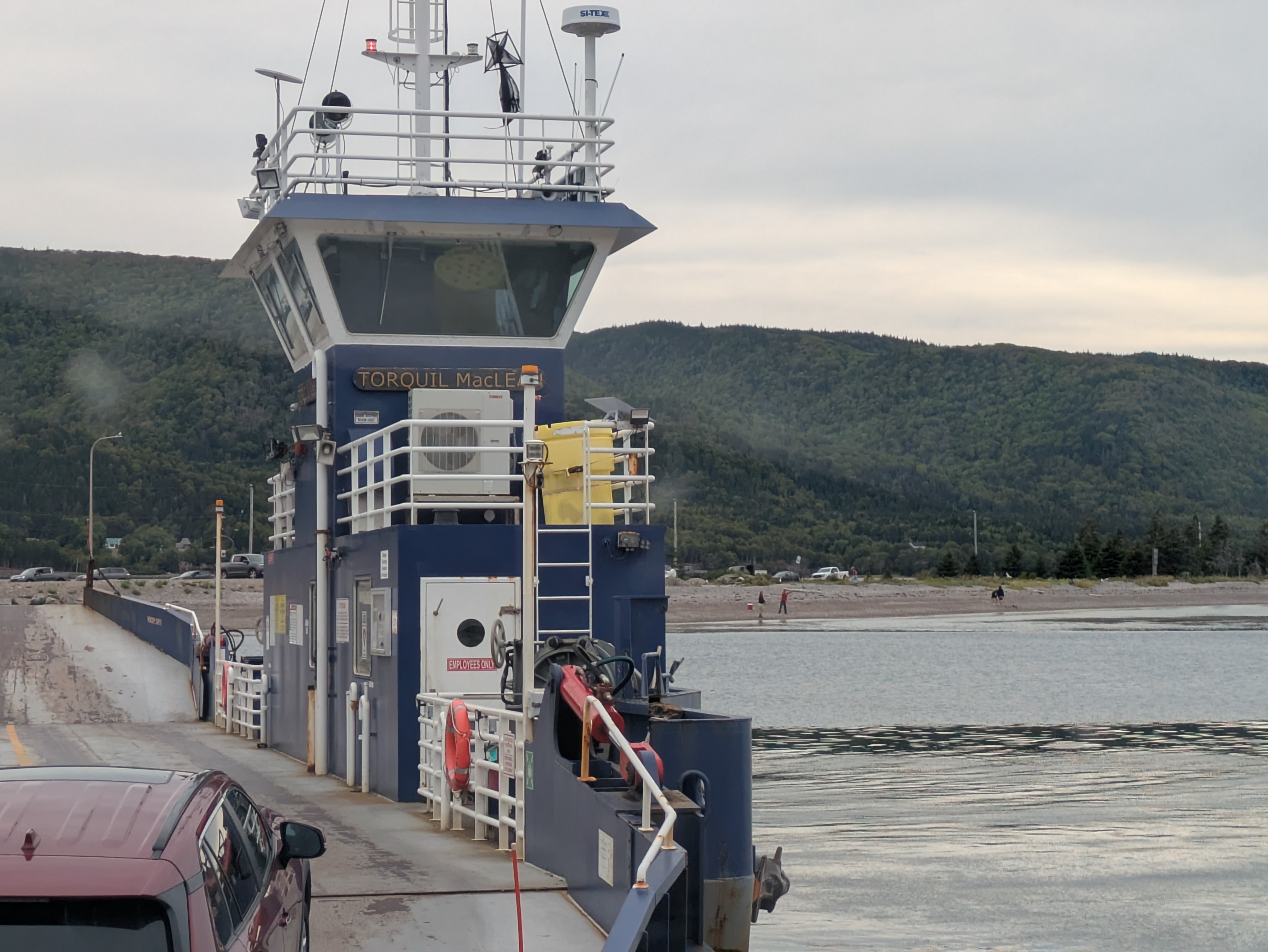
Loading: Vehicles boarding the ferry at Englishtown terminal
🚗 Vehicle Lineup
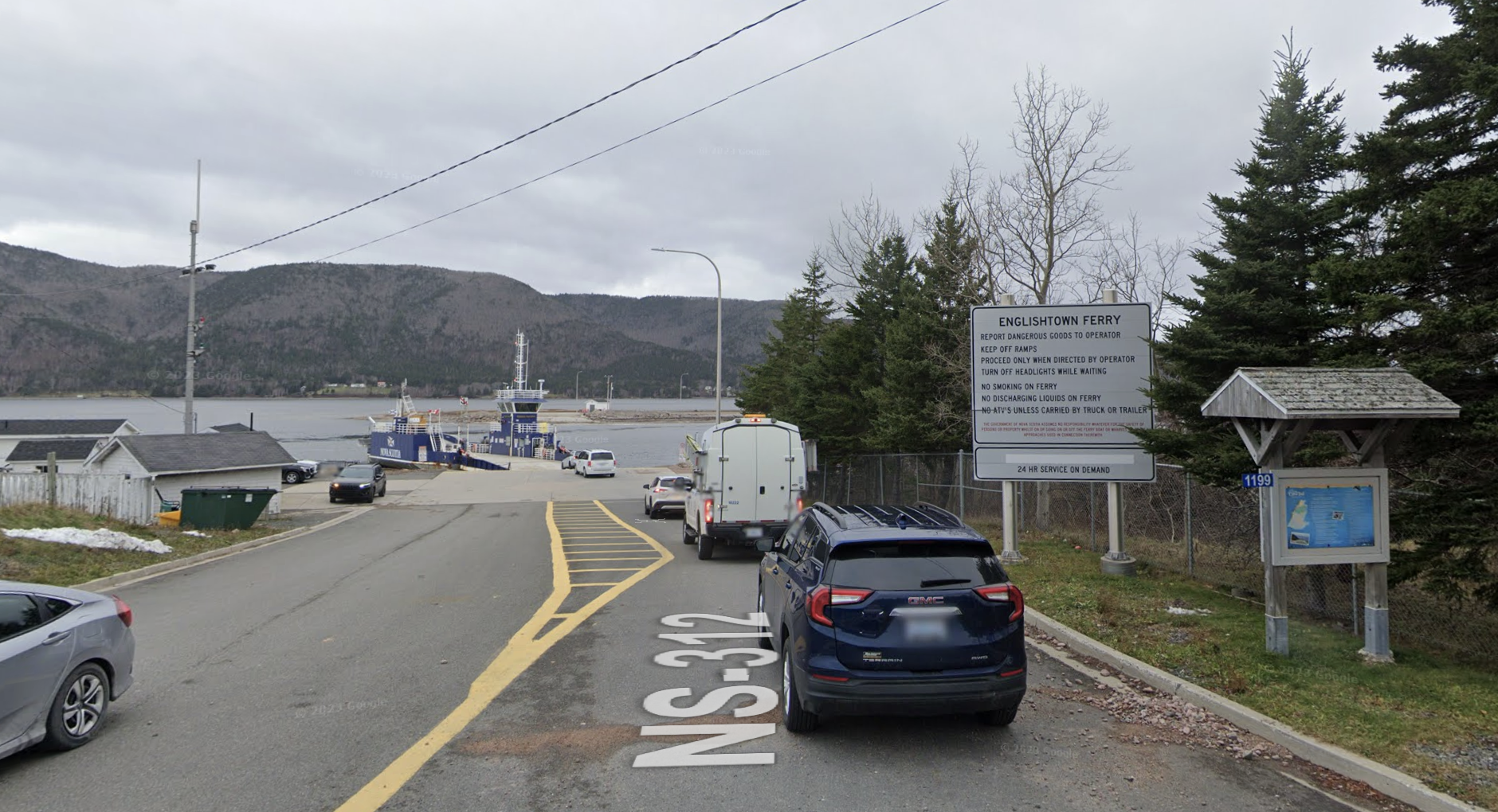
Queue: Vehicles waiting in line to board the ferry
⚓ Docking Operations
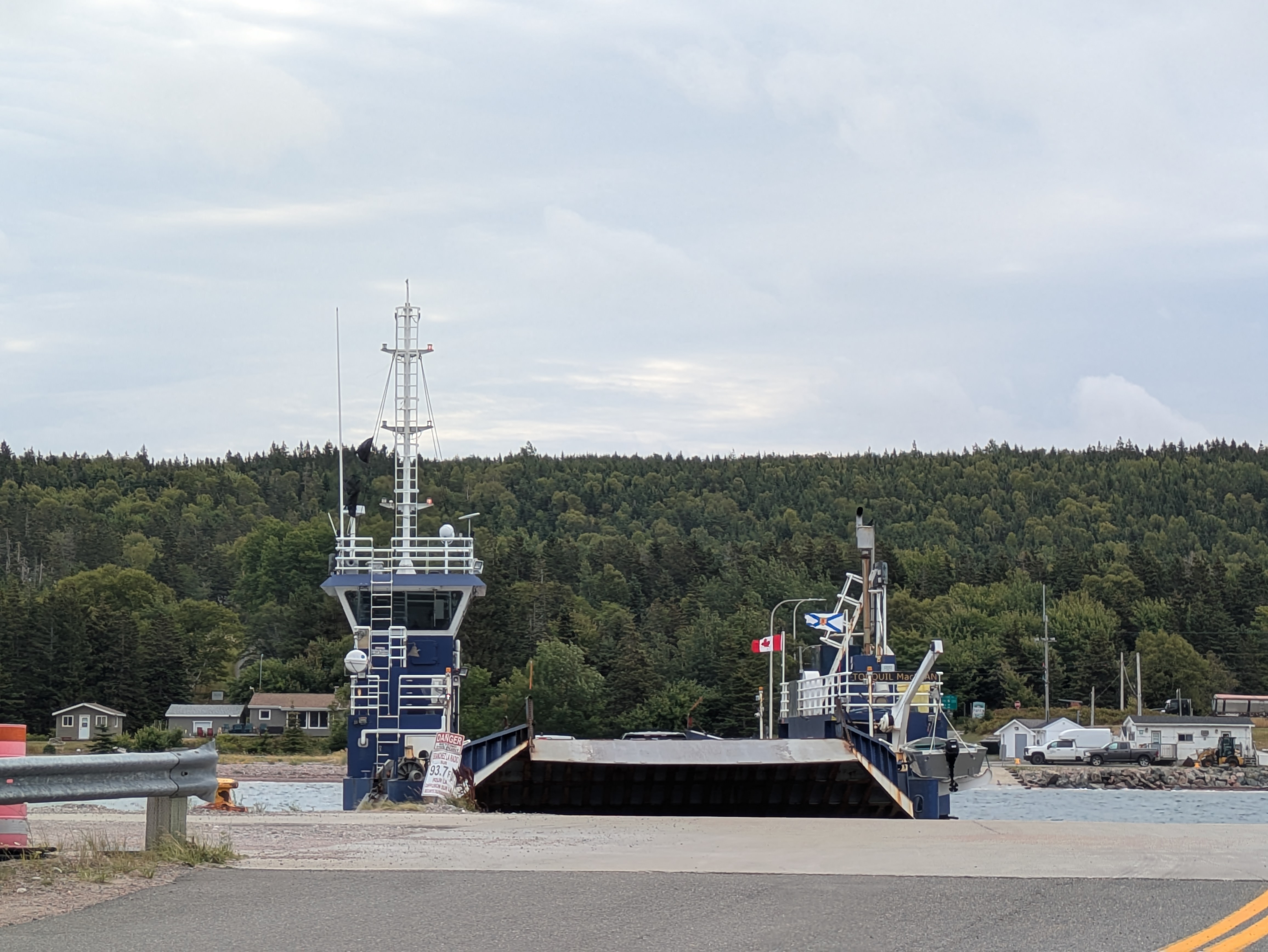
Arrival: Ferry docking at Jersey Cove terminal
📋 Ferry Rules & Guidelines
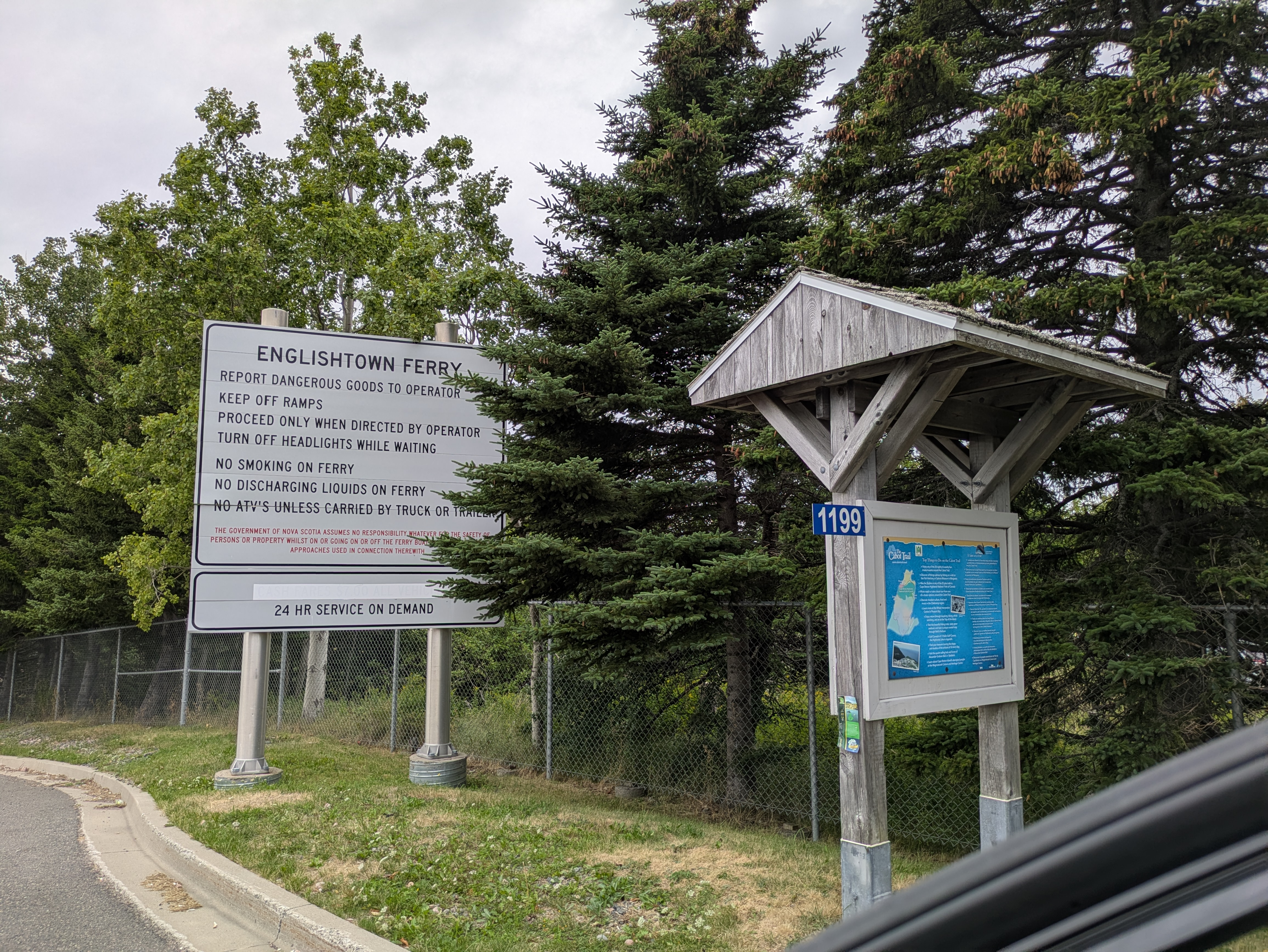
Guidelines: Ferry rules and safety information posted at terminal
🏝️ Jersey Cove Rules
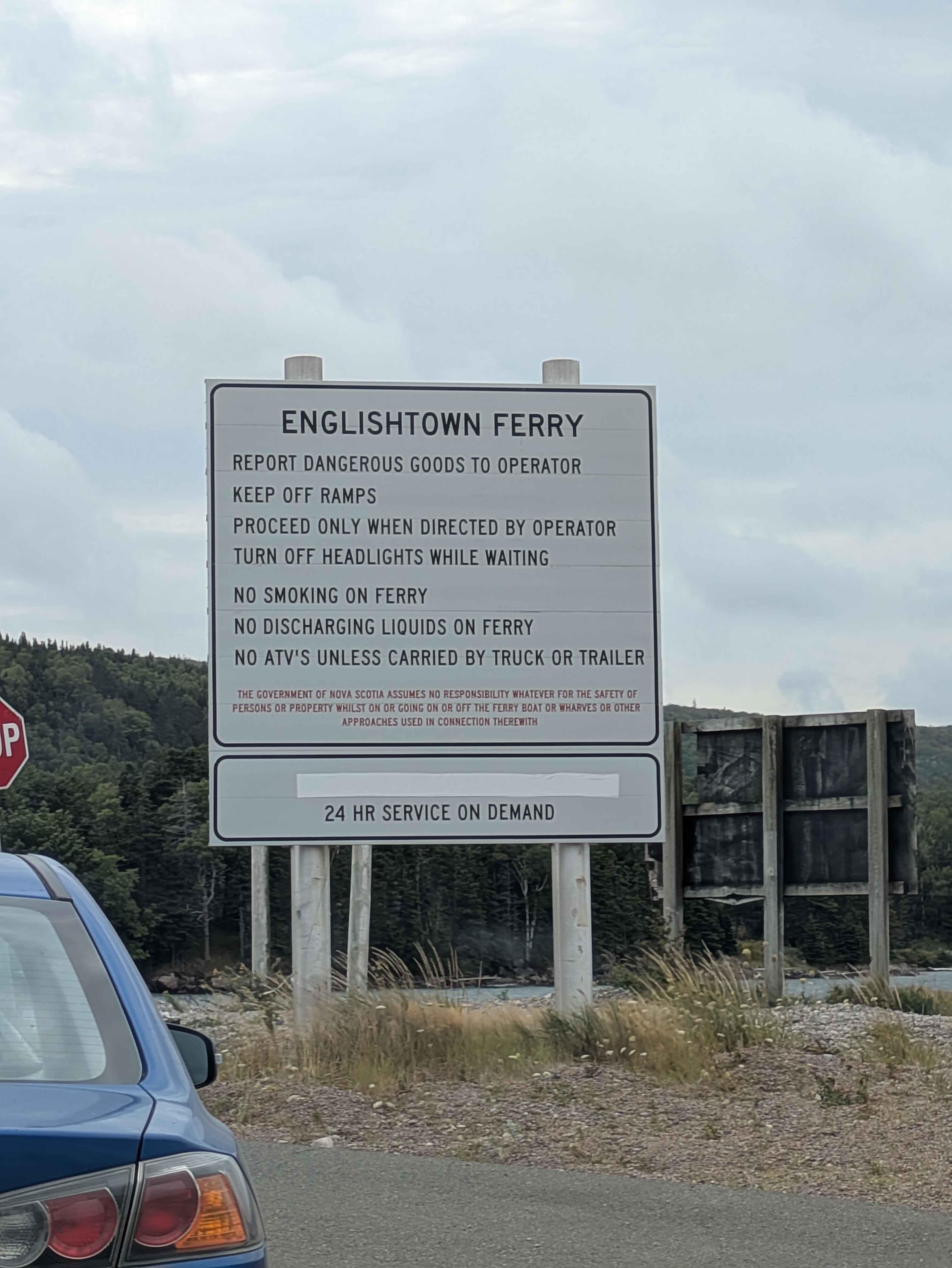
Safety: Ferry rules and guidelines at Jersey Cove terminal
🚢 Ferry Interior View
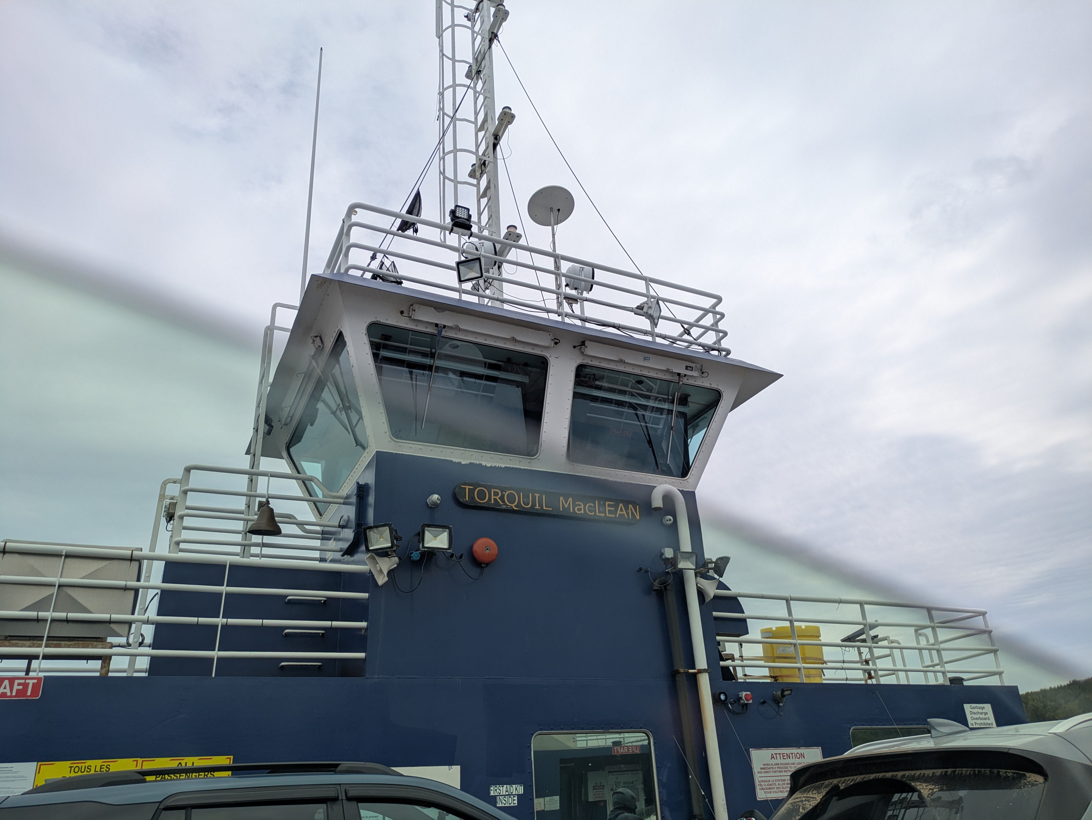
Onboard: Interior view showing vehicles on the ferry deck
🧭 Explore FerryLight Features
💡 The Story Behind FerryLight
The Daily Challenge: Living part-time in Cape Breton, I faced the same frustration every day - arriving at the ferry terminal with no idea about wait times or service status. The lack of real-time information made planning impossible and created unnecessary delays.
Building the Solution: My tech background provided the perfect opportunity to solve this problem. I created FerryLight Online to deliver live ferry tracking, wait time predictions, and departure schedules. Though still evolving, the platform is already empowering travelers with the information they need.
Community Insight: Through personal experience, I've learned what matters most to ferry users. It's not about rigid schedules - it's about understanding current conditions to make smart travel decisions.
Quick Ferry Facts & Statistics
⚠️ Operational Variability: These figures represent typical service levels that fluctuate based on seasonal factors, weather patterns, tourism demand, and special events. Peak summer months (June-August) experience substantially higher traffic volumes, while winter operations may face service reductions during severe weather. Our live tracking delivers current operational status.
📊 Information Sources: Data combines official government documentation from the 2015 feasibility study with live operational tracking from FerryLight Online.
⚙️ Measurement Differences: The 2015 government study recorded crossing length as 185 meters with 90-second travel time. Current operations measure 125 meters with approximately 3-minute crossings.
🚨 SEASONAL TRAFFIC PATTERNS: Summer operations show 155+ peak day trips and 123+ daily average vs. significantly lower winter activity. This demonstrates massive seasonal variation in ferry operations with summer traffic often doubling typical winter levels. For current seasonal data, check ferrylight.online.
600*
Daily Vehicles (Est.)
155+
Peak Day Trips (Actual)
10+
Peak Hour Trips (Actual)
📊 Seasonal Statistics: Numbers marked with * are historical estimates that may reflect lower winter/off-season activity. Summer traffic is dramatically higher: 155+ peak days, 123+ summer daily average, and 10+ trips per hour during peak times. This shows massive seasonal variation in ferry operations.
📊 Weekly Ferry Business Analysis
Two bar charts showing ferry usage patterns: daily breakdown and hourly distribution from live tracking data.
📈 Weekly Total Trips
1007
Total ferry trips for the week
📅 Daily Breakdown
🕐 Hourly Distribution - Monday Example
📋 Data Source: Live ferry tracking data from FerryLight Online for the week of
August 17-20, 2025. Charts show (1) daily breakdown by day and (2) hourly patterns
for Monday as an example. Data collected via AIS tracking and updated in real-time.
📊 Advanced Analytics: For comprehensive ferry statistics, interactive charts, and busyness analysis, visit our
Ferry Statistics & Analytics Dashboard. View hourly patterns, peak times, and historical performance data with real-time updates.
🗺️ Ferry Location & Visual Guide
📷 Current Ferry Operations (2025)

Englishtown Terminal: Cars waiting to board the free ferry service

Active Crossing: Ferry en route across St. Ann's Bay (3 minutes)

Night Service: 24/7 operations including overnight crossings
📸 Real-Time Visual Updates
These images show current ferry operations. For live ferry position and real-time status, visit our live tracking page. Images are updated regularly to reflect seasonal conditions and operational changes.
📍 Interactive Map & Location Details
🚢 Englishtown Terminal
Coordinates: 46° 17' 20" N, 60° 32' 23" W
Address: Route 312, Englishtown, NS
Features: Main terminal, parking area, scenic viewpoint
🚻 Facilities: Modern washrooms with proper amenities
🏝️ Jersey Cove Terminal
Coordinates: 46° 17' 23" N, 60° 32' 29" W
Address: Route 312, Jersey Cove, NS
Features: Secondary terminal, beach access, hiking trails
🚻 Facilities: Basic portable toilets with limited amenities
📸 Ferry Images & Visual Reference

Torquil MacLean cable ferry crossing St. Ann's Bay, September 2011 • Source: Wikipedia
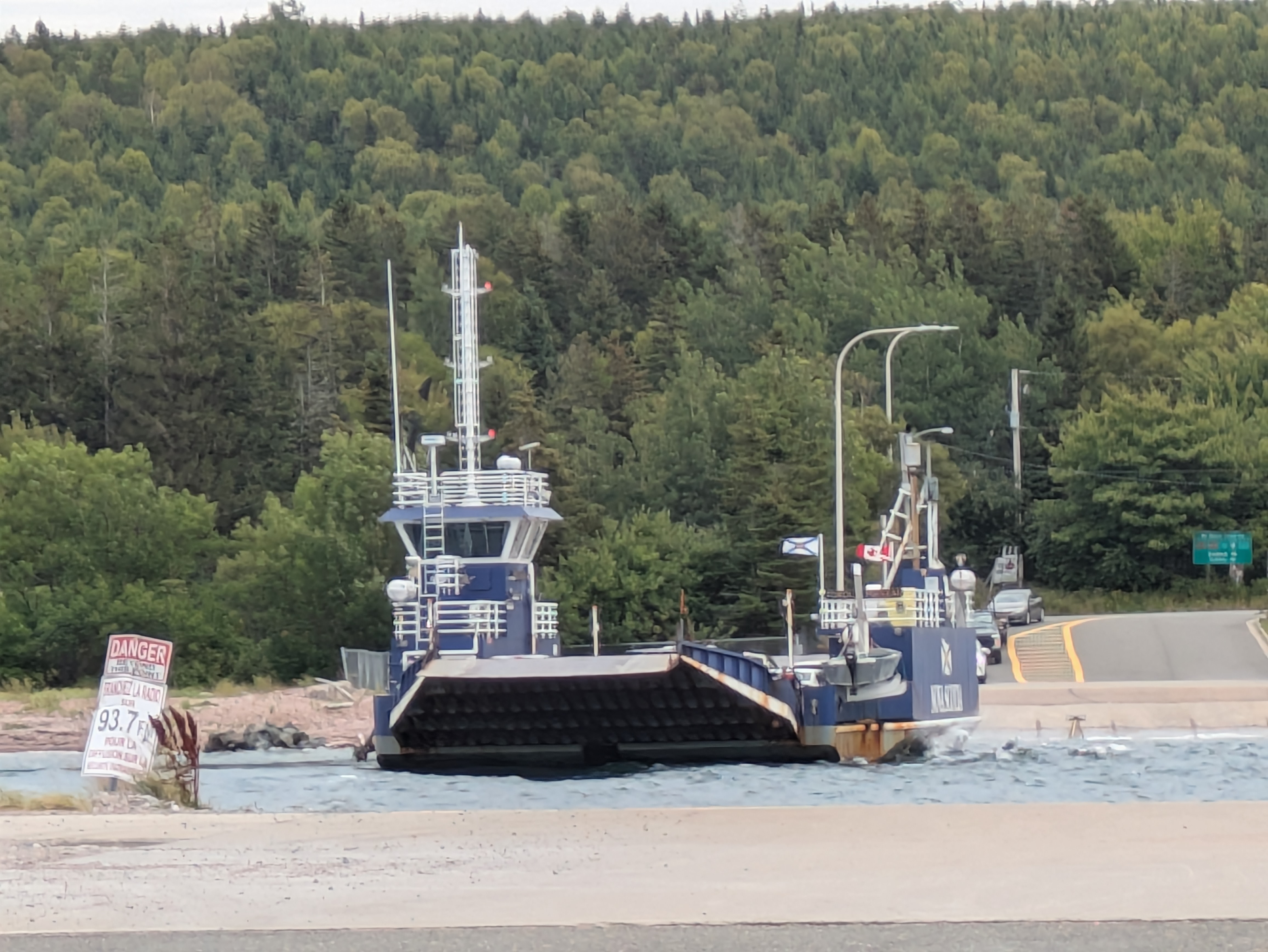
Approach to Englishtown: Ferry arriving at Englishtown terminal from Jersey Cove
📝 Image Note: Click on any image to visit the source website. These images are sourced from public domain and media sources. For current ferry status and live views, use our real-time tracking at ferrylight.online.
Frequently Asked Questions
🚗 What is the vehicle capacity of the Englishtown Ferry?
Answer: The Torquil MacLean cable ferry can transport 15 vehicles and 97 passengers per crossing. Designed specifically for vehicle transport across St. Ann's Bay, it accommodates cars, light trucks, and commercial vehicles within weight limits. [Wikipedia](https://en.wikipedia.org/wiki/Englishtown_Ferry) indicates peak season capacity of 600 vehicles daily, while [Saltwire](https://www.saltwire.com/cape-breton/englishtown-cable-ferry-services-busiest-in-the-province-5687) notes it's among the province's busiest ferry services. Our live tracking reveals massive seasonal variation - summer peaks at 155+ trips/day and 123+ daily average vs. much lower winter activity. Summer traffic can be significantly higher than off-season operations, with 10+ trips per hour during peak tourist season.
💰 How much does the Englishtown Ferry cost?
Answer: No cost whatsoever - the ferry operates as a free service for all users. Whether you're driving a vehicle, walking, or cycling, there are zero charges. This reflects Nova Scotia's approach to maintaining essential transportation links as part of the provincial highway network. For detailed cost information, see our
dedicated cost page.
🕐 What are the operating hours of the Englishtown Ferry?
Answer: The Englishtown Ferry operates
24 hours a day, 7 days a week, year-round. It provides on-demand service, meaning it runs when vehicles are waiting to cross. There are no scheduled departure times - the ferry operates continuously to serve the community's transportation needs. Based on our real-time data, the busiest periods are typically 8:00-11:00 AM and 3:00-6:00 PM, with the ferry making up to 8 trips per hour during peak times. For detailed hours information, see our
24/7 hours page.
⏱️ How long does the Englishtown Ferry crossing take?
Answer: The crossing typically takes 3 minutes to traverse the 125-meter span between Englishtown and Jersey Cove. This represents a substantial time savings compared to the 22-minute drive around the bay via the Trans-Canada Highway. The cable ferry design maintains reliable crossing times even during challenging weather.
📍 Where is the Englishtown Ferry located?
Answer: The Englishtown Ferry operates between two locations:
Englishtown Terminal: 46° 17' 20" N, 60° 32' 23" W (46.288938, -60.539956)
Jersey Cove Terminal: 46° 17' 23" N, 60° 32' 29" W (46.289806, -60.541393)
Both terminals are located in Victoria County, Nova Scotia, providing a vital link in the provincial highway system. The ferry carries Nova Scotia Route 312 across the mouth of St. Ann's Bay, making it an essential part of the province's transportation network. For detailed location information and maps, visit the [Ferryman website](https://ferryman.ca/fm/cans03_englishtown/englishtown.php).
🚢 What type of ferry is the Englishtown Ferry?
Answer: The Englishtown Ferry is a diesel/hydraulic cable ferry named the "Torquil MacLean." It was built in 2007 by A. F. Theriault & Son Ltd. and designed by E.Y.E. Marine Consultants. As a cable ferry, it uses underwater cables to pull itself across the water, making it very efficient and reliable for this short crossing. According to [Wikipedia](https://en.wikipedia.org/wiki/Englishtown_Ferry), it operates on a 50/50 frequency basis, meaning it runs continuously when vehicles are waiting. For detailed technical specifications, visit [E.Y.E. Marine Consultants](https://www.eyemarine.com/vessel/torquil-maclean-2/).
🗺️ Can I see other boats and marine life on the FerryLight map?
Answer: Yes! Our enhanced multi-vessel area mapping feature shows all boats in the North Shore area, plus sea animals and aircraft! Simply zoom out on the ferry status map to discover a complete maritime picture including:
🚢 Tour Boats: Puffin Tours, Puffin Express, and other tourist vessels
📦 Freight Ships: Commercial cargo and fishing vessels
⛵ Recreational Craft: Pleasure boats, sailboats, and motor yachts
🦈 Sea Animals: Sharks and other marine wildlife markers
✈️ Aircraft: Planes and helicopters flying over Cape Breton
How it works: Different zoom levels reveal different vessel types and markers. At close zoom, you see just the ferry. As you zoom out, more vessels, sea animals, and aircraft appear, giving you complete maritime and aerial awareness of the North Shore area.
Use the full screen option to see all markers beyond the Englishtown focus area!
🔍 Full Screen Viewing: Many sea animals and aircraft markers are located beyond the default Englishtown focus area. Click the full screen button or zoom out significantly to see sharks, marine life, and aircraft flying over Cape Breton Island.
Real-time updates: All vessel positions, sea animal sightings, and aircraft tracking are updated via AIS (Automatic Identification System) data and marine monitoring systems, providing live maritime traffic and wildlife information for the entire region.
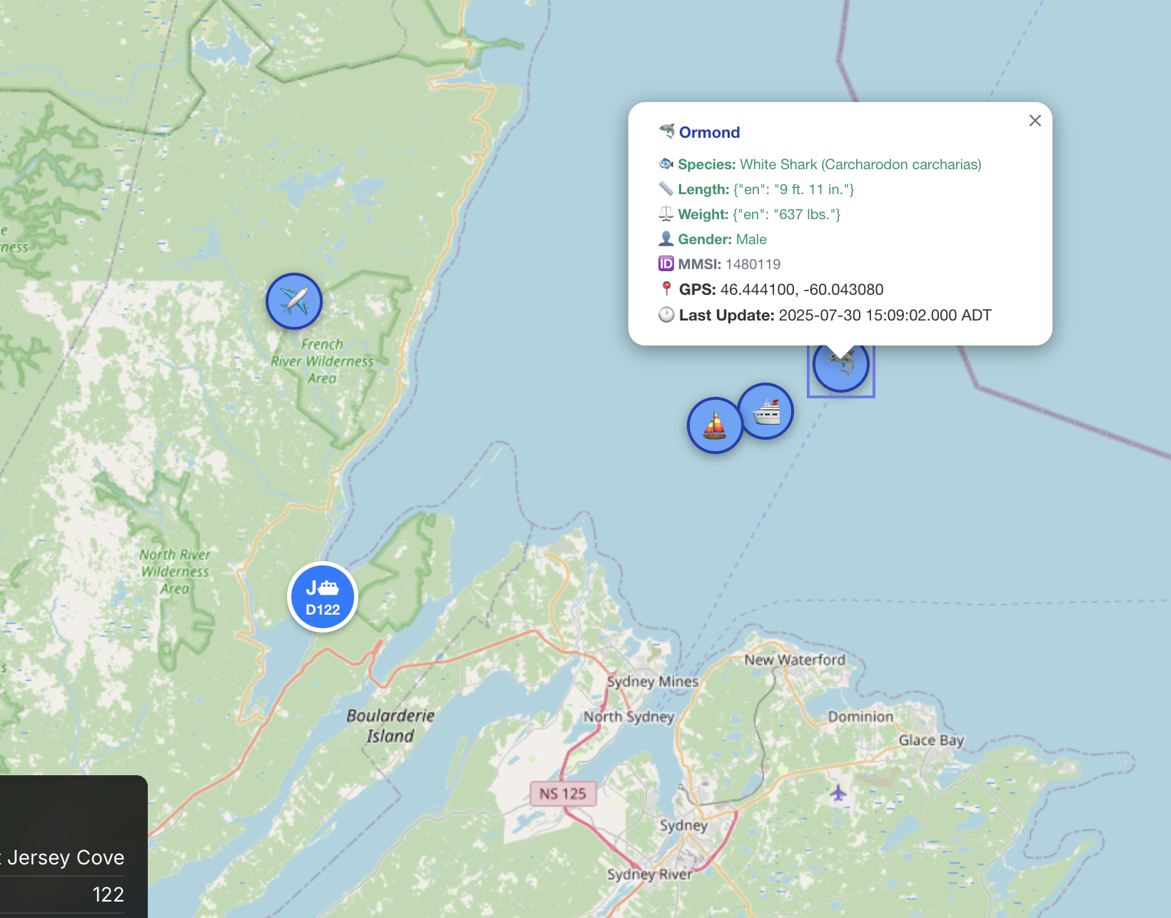
Extended View: This screenshot shows the expanded map view with ships, aircraft flying over Cape Breton,
and sea animals including sharks. Use the full screen option and zoom out to see all these markers beyond the
standard Englishtown ferry focus area. Each marker displays detailed information including position, speed, and last update time.
📱 How can I check real-time Englishtown Ferry status?
Answer: Use
FerryLight Online to get real-time ferry status, live tracking, and current wait times. Our platform provides:
• Live AIS tracking of ferry position with exact coordinates
• Real-time wait time updates and departure predictions
• Current weather conditions affecting operations
• Historical data and patterns (we track up to 8 weeks of data)
• Peak hour analysis (8:00-9:00 AM is busiest with 8 trips)
• Daily trip counts (currently tracking 96+ trips today - exceeding historical estimates!)
• Docking efficiency metrics and timing predictions
Visit
ferrylight.online for live updates every minute with data that no other platform provides.
Personal Note: I built this system because I got tired of arriving at the ferry terminal not knowing the wait time or if the ferry was even running. Now you can check the current situation before you leave home! Today's data shows why real-time tracking is crucial - we're already at 96+ trips, well above the 81 peak day estimate!
🌊 Does weather affect Englishtown Ferry operations?
Answer: Yes, weather conditions can impact ferry operations. The ferry may experience delays or temporary suspension during:
• High winds (25+ km/h can cause 10-15 minute delays)
• Dense fog (may suspend service temporarily)
• Severe ice conditions in winter
• Extreme weather events
FerryLight Online provides real-time weather monitoring to help you plan your crossing. Our data shows that docking times can vary significantly - from 5 minutes to over 9 minutes depending on conditions, which we track in real-time.
🚲 Can I bring my bicycle on the Englishtown Ferry?
Answer: Yes! Bicycles are welcome on the Englishtown Ferry at no extra cost. This is part of Nova Scotia's commitment to sustainable transportation. Cyclists can board and disembark safely, and the short crossing time makes it an excellent option for bike tours of Cape Breton Island. Our data shows that the ferry operates efficiently even during peak hours, with consistent 2-minute crossing times regardless of passenger load. For more information on ferry policies, see the [official Nova Scotia ferries page](https://novascotia.ca/tran/hottopics/ferries.asp).
🚛 Are there vehicle restrictions for the Englishtown Ferry?
Answer: ⚠️ IMPORTANT SAFETY WARNING: The Englishtown Ferry has steep approach and departure ramps that create significant restrictions for certain vehicles:
🚫 NOT RECOMMENDED:
• RVs and large trailers: High risk of scraping and damage
• Vehicles towing trailers: Multiple reports of broken hitches
• Low-clearance vehicles: May scrape on steep ramp inclines
• Extra-long vehicles: Difficulty navigating the loading angle
⛽ SPECIAL HAZARDOUS MATERIALS PROTOCOL:
• Gasoline/fuel trucks: Must cross alone without other vehicles for safety
• Hazardous material vehicles: Special ferry protocols apply
• ⏰ Extended wait times: Other vehicles must wait for solo crossing completion
• Advanced notice recommended: Contact ferry operators for large fuel deliveries
📊 Reported Issues:
• Social media and TripAdvisor reviews document scraping damage
• Broken trailer hitches due to steep ramp angles
• Vehicles unable to board safely with trailers attached
✅ ALTERNATIVE ROUTE:
If you're towing or driving a large vehicle, use the St. Ann's Loop (22-minute drive via Trans-Canada Highway) instead of risking damage. The highway route is free and designed for all vehicle types.
💡 RECOMMENDATION: When in doubt, choose the St. Ann's Loop for safety. Vehicle damage is not covered by the ferry service, and repairs in rural Cape Breton can be costly and time-consuming.
📞 FOR FUEL TRUCKS: Consider calling ahead during busy periods to coordinate your solo crossing and minimize wait times for other travelers.
👥 Who operates the Englishtown Ferry?
Answer: The Englishtown Ferry is operated by the Nova Scotia Department of Transportation and Infrastructure Renewal as part of the provincial highway system. It's one of seven provincially operated ferries in Nova Scotia, including four cable ferries and three ocean-going ferries. According to [Nova Scotia Explorer](https://novascotiaexplorer.com/ferries-to-nova-scotia/), all provincial ferries have been free to use since June 2021, making the Englishtown Ferry an even more attractive option for travelers. For official government information, visit the [Nova Scotia Provincial Ferries page](https://novascotia.ca/tran/hottopics/ferries.asp).
🗺️ How does FerryLight's ferry location mapping work?
Answer: Our advanced ferry location mapping provides real-time visibility into ferry operations! Here's how it works:
Live AIS Tracking: We integrate with the Automatic Identification System to show the ferry's exact GPS position, updated every minute
Interactive Map: Zoom in/out to see ferry location, route patterns, and docking zones
Real-Time Updates: Watch the ferry move across St. Ann's Bay in real-time
Docking Zone Analysis: See exactly where the ferry docks at each terminal
Historical Patterns: View typical routes and docking behaviors
Map Interface Guide:
•
Green Marker (E D105): Main Englishtown Ferry with live status
•
Blue Markers: Other vessels in the area (tour boats, freight ships, etc.)
•
Dotted Lines: Vessel movement paths and historical routes
•
Terminal Labels: Clear identification of Englishtown and Jersey Cove
Simply visit
ferrylight.online and use the interactive map to track your ferry in real-time!
⏱️ How does FerryLight calculate wait times?
Answer: Our intelligent wait time system never makes you guess! We use advanced algorithms that analyze multiple data points:
Real-Time Data:
• Current ferry position and ETA
• Live vehicle queue length at each terminal
• Current weather conditions affecting operations
• Ferry capacity and loading patterns
Smart Predictions:
• AI-powered estimates based on historical patterns
• Vehicle type analysis (cars, trucks, commercial vehicles)
• Peak hour adjustments for tourist season
• Weather impact assessment on loading times
• Personalized estimates for your specific situation
Accuracy: Our system updates every minute and provides wait time predictions that help you plan your crossing efficiently. No more arriving at the terminal to find unexpected delays!
🚦 What if the ferry isn't running? What are my alternatives?
Answer: Don't worry - we've got you covered with smart alternative route recommendations! When the ferry isn't running, our system automatically recommends the St. Ann's Loop as your best alternative:
🛣️ St. Ann's Loop Route:
• Path: Englishtown → Trans-Canada Highway → St. Ann's Bay → Jersey Cove
• Distance: Approximately 35 km around the bay
• Driving Time: 22-25 minutes depending on traffic and weather
• Scenic Highlights: Beautiful coastal views and Cape Breton landscapes
Smart Routing Tips:
• Choose Ferry When: Wait time < 20 minutes (saves time and fuel)
• Choose St. Ann's Loop When: Wait time > 20 minutes or ferry not running
• Weather Considerations: Bad weather may make driving around preferable
• Scenic Preference: St. Ann's Loop offers beautiful Cape Breton views
Real-Time Updates: Our system monitors ferry service status continuously and provides immediate alerts for service disruptions, mechanical issues, or weather delays. You'll always know your options!
🎯 How does FerryLight help me choose between ferry and driving around?
Answer: Our intelligent route optimization engine makes the decision for you! We compare both options in real-time:
Ferry Route Analysis:
• 3-minute actual crossing time
• Current wait time at terminal
• Total time = crossing + wait
• Fuel savings vs. driving
St. Ann's Loop Analysis:
• 22-25 minute driving time around the bay
• Current road conditions and traffic
• Weather impact on driving
• Additional fuel cost
Smart Recommendations: Our system automatically recommends the best route based on current conditions. When ferry wait times exceed 20 minutes, we suggest the St. Ann's Loop. When waits are under 20 minutes, the ferry saves you time and fuel.
Personal Preferences: You can also factor in scenic preferences, weather comfort, and time sensitivity to make the final decision. Our goal is to give you all the information you need to choose wisely!
🔍 How do I use the full screen map to see sea animals and aircraft?
Answer: To see all the sea animals (sharks) and aircraft flying over Cape Breton, you need to use the full screen viewing option! Here's how:
Step-by-Step Instructions:
•
Step 1: Visit
ferrylight.online and locate the ferry map
•
Step 2: Click the
full screen button (usually in the corner of the map)
•
Step 3: Use the
zoom out controls (-) to expand your view beyond Englishtown
•
Step 4: Pan around the map to explore Cape Breton waters and airspace
🦈 Finding Sea Animals:
• Sharks and marine wildlife markers appear in Cape Breton waters
• Look for distinctive sea animal icons beyond the ferry route
• Click on any marker for detailed information
✈️ Spotting Aircraft:
• Planes and helicopters show as aircraft icons over Cape Breton Island
• Aircraft markers update in real-time showing flight paths
• Each aircraft displays speed, altitude, and destination information
💡 Pro Tip: The default map focuses on the Englishtown ferry area. Most sea animals and aircraft are
outside this focus zone, so full screen viewing and zooming out are essential to see the complete Cape Breton maritime and aerial picture!
📞 How can I contact the Englishtown Ferry?
🚗 What kind of vehicles can the Englishtown Ferry accommodate?
Answer: The Englishtown Ferry is a cable ferry that carries cars, light trucks, commercial trucks, bicycles, and pedestrians. It has a capacity of 15 vehicles and 97 passengers per crossing. The ferry accommodates various vehicle types within weight and size limits, making it accessible for all types of travelers.
📍 Where is the Englishtown Ferry located?
Answer: The Englishtown Ferry is located on Route 312 in Englishtown, Nova Scotia, crossing St. Ann's Bay between Englishtown and Jersey Cove. It's easily accessible from the Cabot Trail and serves as a vital connection for the Northshore area.
⚡ Is it faster to take the ferry or drive around the bay?
Answer: The ferry is a significant shortcut and much faster than the alternative drive around the bay, especially for those continuing on the Cabot Trail. The ferry takes 3 minutes vs. a 22-minute drive around the bay via the Trans-Canada Highway, saving substantial time and fuel.
⏰ Do people have to wait long for the Englishtown Ferry?
Answer: Since it operates on demand, waiting times are usually minimal, though they can be longer during peak tourist season. The ferry runs continuously when vehicles are waiting, so you typically won't wait more than a few minutes. During busy summer periods, wait times may be longer due to increased traffic.
🌉 Why is there a ferry instead of a bridge?
Answer: While a bridge has been considered, the ferry is a long-standing tradition and a charming part of the local experience. The tides and currents in the bay are also a factor in maintaining the ferry service. The ferry preserves the scenic beauty of the area while providing an efficient transportation solution.
🚢 What is the name of the Englishtown Ferry boat?
Answer: The ferry is called the Torquil MacLean, named after a local historical figure who operated the original ferry service in the 1870s. The name was chosen through a student essay contest in 2008, honoring the area's ferry heritage.
📸 Is the Englishtown Ferry a scenic route?
Answer: Yes, the short crossing offers picturesque views of the surrounding coastline and St. Ann's Bay, making it a popular photo opportunity for tourists and locals alike. The scenic beauty is one of the reasons why the ferry remains preferred over a bridge replacement.
📚 What is the history of the Englishtown Ferry?
Answer: The Englishtown Ferry has a fascinating
150+ year history connecting communities across St. Ann's Bay:
🚣 1871 - The Beginning:
Ferry service began when
Torquil MacLean (born 1840 at Wreck Cove) started operating with a large rowboat to transport passengers and goods across St. Ann's Bay. According to his grandson Captain Harry C. Morrison, Torquil was
"short of stature but built like a wrestler and strong as an ox" with a heavy beard, but
"a good natured man, and had a heart of gold." When horses needed crossing, they would
swim behind the boat attached by rope while Torquil rowed the carriage across. As traffic increased, he commissioned the famous
"Old Scow" (20 feet long, 9 feet wide) from Kenneth and Alex Morrison in Wreck Cove, capable of carrying two horses and one carriage.
[Sources: Captain Morrison - Family Account, Cape Breton Magazine]
🏛️ 1921 - Government Takes Over:
The first government-operated ferry and ferry wharfs were established in 1921. The initial ferry boat was built at Bay St. Lawrence by a Fitzgerald - about thirty-five feet long and eleven feet wide, equipped with a twelve-horsepower Acadia motor, and could carry one car.
🚗 1936 - Capacity Expansion:
The original ferry was replaced by a larger boat built by Best and Hussy at Ingonish, capable of carrying two to three cars, serving the community for forty years.
🚗 1952-1997 - Mid-Century Development:
Multiple ferry generations served the community, including the
Highland Lass (1952) built in North Sydney and the
Gordon S. Harrington which came from New Campbellton when the Seal Island Bridge opened.
⚓ 1976-2008 - The Angus MacAskill Era:
The ferry
"Angus MacAskill" was introduced in 1976, serving faithfully for
32 years until 2008. Built by Sydney Engineering and Drydock for $750,000, this 12-car vessel operated 24 hours a day, becoming one of Nova Scotia's busiest provincial ferries.
🎓 2008 - Students Name & Ferry Christened:
In April 2008,
125 students from four local schools (Baddeck, Middle River, Cape Smokey, and Boularderie) wrote essays choosing between "Torquil MacLean" or "Angus MacAskill II." Students chose to honor
Torquil MacLean, who operated the ferry for 50 years. On
September 24, 2008, the
"Torquil MacLean" was officially christened, replacing the Angus MacAskill. This $4-million cable ferry can carry 15 cars (vs. 12 on the previous ferry).
🔧 2014-2018 - Upgrades & Infrastructure:
The Torquil MacLean underwent major upgrades in 2014 including hull strengthening and engine replacement. In 2018, new slipway construction presented temporary challenges while improving long-term infrastructure.
[Sources: Ferry Christening (2008), CTV Atlantic (2015)]
🌊 Today - Busiest Provincial Ferry:
The Englishtown Ferry remains the busiest of Nova Scotia's seven provincially operated ferries, handling about 50% of the province's total ferry traffic. It operates 24/7 on demand and continues the proud tradition of connecting Cape Breton communities that began over 150 years ago.
👥 MacLean Family Legacy:
The MacLean family's involvement spans
more than 150 years of ferry operations, making them central to the transportation history of St. Ann's Bay. Today's "Torquil MacLean" ferry honors this incredible family legacy and community service.
[Sources: Nova Scotia Government, Cape Breton Magazine]
🎓 How did students help name the current ferry?
Answer: The naming of the current ferry is a wonderful example of
community involvement in local history! In 2008, when the new ferry was being introduced, the Nova Scotia Department of Transportation sought input from local students:
📝 The Essay Contest:
•
125 students from four local schools participated
• Schools included:
Baddeck, Middle River, Cape Smokey, and Boularderie
• Students wrote essays stating which name they favored
• Two finalist names:
"Torquil MacLean" or "Angus MacAskill II"
🏆 The Decision Process:
• Schools forwarded the most representative essays to the department
• A committee reviewed the submissions and recommended the final name
•
Students chose "Torquil MacLean" to honor the area's ferry heritage
• Two winning essays were selected (one high school, one elementary/junior high)
🎉 Recognition:
The winning students received their prizes at a christening ceremony in June 2008. Murray Scott, Minister of Transportation, praised the quality of the essays and the students' understanding of local heritage.
[Source: Nova Scotia Government News, April 22, 2008]
📚 Educational Impact:
Many students paid tribute to the rich heritage of the area and highlighted the contributions of both the Giant MacAskill and Mr. MacLean, demonstrating how this naming process became a valuable lesson in local history and community engagement.
🏗️ Is there a bridge planned to replace the Englishtown Ferry?
Answer: In 2015, the Nova Scotia Department of Transportation and Infrastructure Renewal completed a comprehensive [Feasibility Study for Bridge Replacement](https://novascotia.ca/tran/Englishtown_Ferry_Bridge_Replacement_Feasibility_Study.pdf) that analyzed the economic implications of replacing the ferry with a bridge. The study revealed some fascinating insights about the current ferry's performance and costs:
Current Ferry Operations (2015 Study Data):
• Annual Voyages: 45,000 crossings
• Vehicle Traffic: 226,000 vehicles annually
• Passengers: 470,000 people annually
• Annual Operating Cost: $1,254,239
• Fees Collected: $477,200 (before becoming free in 2021)
• Crossing Time: 90 seconds (vs. our current data showing ~3 minutes)
Future Considerations:
• The Torquil MacLean will need replacement in 20 years
• New cable ferry estimated cost: $8.0 Million (2015 dollars)
• Dry docking every 4 years at ~$400,000
• Any new bridge would be designed for 75-year lifespan
While the study provided detailed analysis, no concrete bridge plans have materialized. The cable ferry continues to provide an efficient, environmentally-friendly solution that maintains the scenic beauty of the area while serving transportation needs.
💰 What are the costs of operating the Englishtown Ferry?
Answer: According to the official 2015 [Feasibility Study](https://novascotia.ca/tran/Englishtown_Ferry_Bridge_Replacement_Feasibility_Study.pdf), the Englishtown Ferry has significant operational costs:
Annual Operating Costs (2015):
• Total Operating Cost: $1,254,239 per year
• Revenue from Fees: $477,200 (before becoming free in 2021)
• Net Cost to Province: $777,039 annually
Major Cost Components:
• Ferry Replacement: $8.0 Million every 30 years
• Dry Docking: $400,000 every 4 years
• Staffing: 24/7 operations require multiple crews
• Maintenance: Regular cable and mechanical upkeep
Economic Impact: Despite these costs, the ferry serves as a vital economic link for Cape Breton's tourism industry and local communities. The 2015 study showed it handled 226,000 vehicles and 470,000 passengers annually, making it one of Nova Scotia's busiest ferry crossings.
⚙️ What are the technical specifications from the 2015 government study?
Answer: The 2015 [Feasibility Study](https://novascotia.ca/tran/Englishtown_Ferry_Bridge_Replacement_Feasibility_Study.pdf) provides detailed technical specifications that differ slightly from current operations:
Operational Specifications (2015 Study):
• Annual Voyages: 45,000 crossings per year
• Operating Mode: Sails on Demand (24/7 service)
• Voyage Length: 185 meters (vs. current 125m)
• Crossing Time: 90 seconds (vs. current ~3 minutes)
• Vehicle Traffic: 226,000 vehicles annually
• Passenger Volume: 470,000 people annually
Infrastructure & Maintenance:
• Ferry Lifespan: 30 years (average for cable ferries)
• Current Age: Torquil MacLean built in 2007, will need replacement in ~20 years
• Replacement Cost: $8.0 Million for new cable ferry (2015 dollars)
• Dry Docking: Required every 4 years at ~$400,000 per session
Note: The 2015 study provides official government baseline data, while our real-time data shows current operations.
🚻 What are the toilet facilities like at the ferry terminals?
Answer: 🚨 IMPORTANT FACILITY UPDATE: There's a significant difference in toilet facilities between the two ferry terminals:
🏝️ Jersey Cove Side - Basic Facilities:
• Basic portable toilets available for public use
• Limited amenities - just essential facilities
• Seasonal availability depending on tourist season
🏘️ Englishtown Side - Superior Facilities:
• Modern, well-maintained washrooms with proper plumbing
• Clean, accessible facilities available year-round
• Better amenities including proper sinks and handwashing
• More comfortable experience for travelers
💡 Travel Tip: If you need to use the facilities, the Englishtown terminal offers a much better experience. The Jersey Cove side has basic portable toilets that may not be as comfortable or well-maintained. Plan your bathroom breaks accordingly!
📸 Visual Comparison: Recent photos show the contrast between the basic portable facilities at Jersey Cove and the modern washrooms at Englishtown.
🚻 Toilet Facilities Comparison
See the difference in facilities between the two ferry terminals
🏝️ Jersey Cove Side
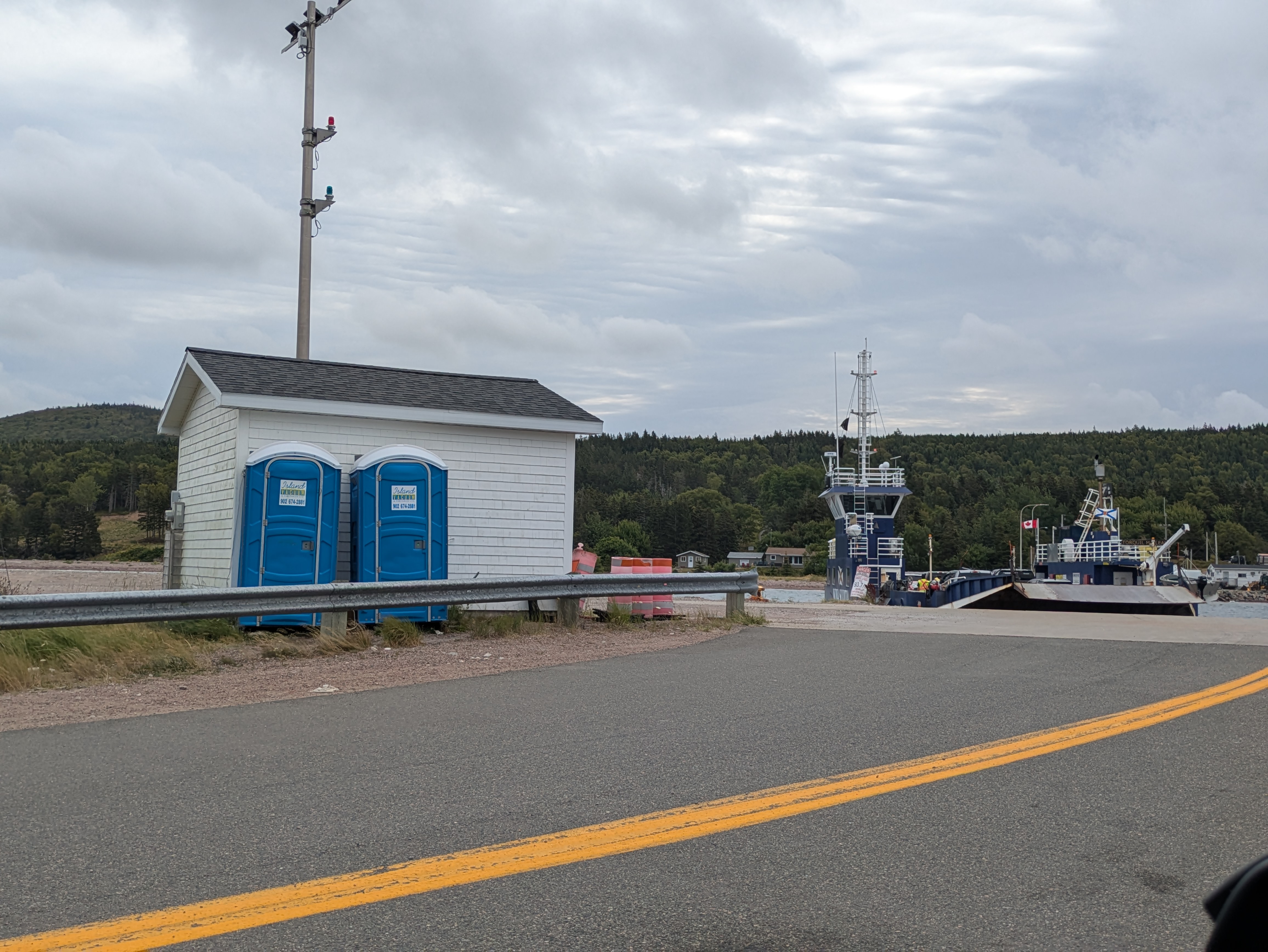
Current Status: Basic portable toilets with limited amenities
🏘️ Englishtown Side
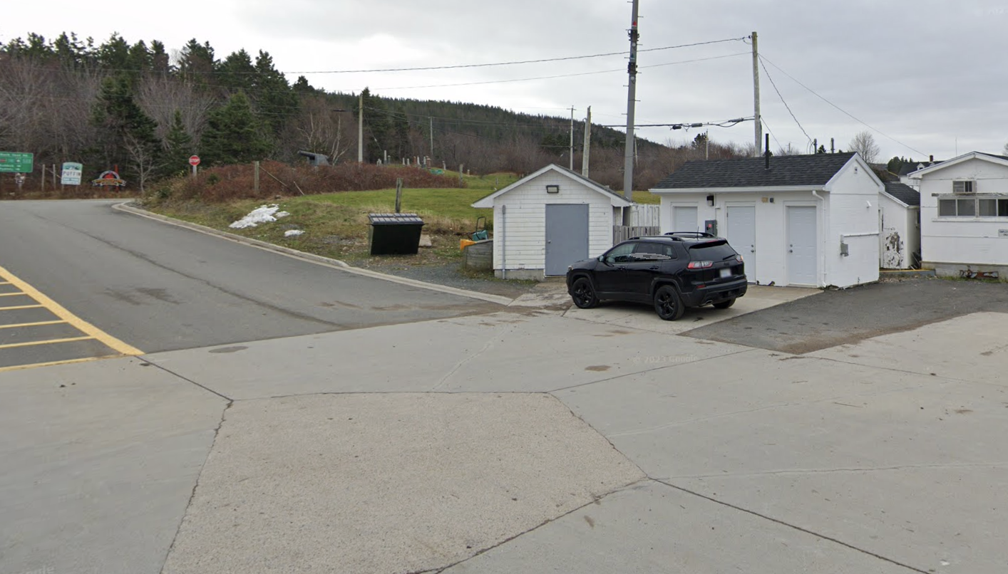
Current Status: Modern, well-maintained washrooms with proper amenities
📋 Facility Comparison Summary
🏝️ Jersey Cove
- Basic portable toilets
- Limited amenities
- Seasonal availability
- Essential facilities only
🏘️ Englishtown
- Modern washrooms
- Proper plumbing
- Year-round availability
- Better amenities
💡 Travel Tip: Plan your bathroom breaks at the Englishtown terminal for a much better experience!
Official Government Information
🏛️ Nova Scotia Department of Transportation and Infrastructure Renewal
The Englishtown Ferry is officially operated by the Nova Scotia Department of Transportation and Infrastructure Renewal as part of the provincial highway system. It's classified as a diesel/hydraulic cable ferry and provides essential transportation infrastructure for Victoria County, carrying Nova Scotia Route 312 across St. Ann's Bay.
📋 Ferry Specifications (Official Data)
- Vessel Name: Torquil MacLean
- Built: 2007
- Type: Diesel/Hydraulic Cable Ferry
- Capacity: 15 cars, 97 people
- Daily Capacity: Up to 600 vehicles
- Crossing Distance: 125 meters (410 feet)
- Crossing Time: ~3 minutes
- Route: Nova Scotia Route 312
- Frequency: 50/50 (continuous operation when needed)
🚻 Terminal Facilities (Current Status)
- Englishtown Terminal: Modern washrooms with proper plumbing and amenities
- Jersey Cove Terminal: Basic portable toilets with limited facilities
- Recommendation: Use Englishtown facilities for better experience
- Availability: Both terminals have facilities, but quality varies significantly
📊 FerryLight Live Performance Data
- Current Status: Docked at Englishtown (as of latest update)
- Peak Performance: Currently tracking 96+ trips today - exceeding historical estimates!
- Live Peak Performance: 155+ trips on busy summer days (actual tracking data)
- Busiest Hours: 8:00-9:00 AM (8 trips), 9:00-10:00 AM (8 trips)
- Average Trip Times: To Englishtown: 1m 49s, To Jersey Cove: 1m 54s
- Docking Efficiency: Jersey Cove: 6m 46s, Englishtown: 6m 31s
- Real-Time Tracking: Updates every minute with exact coordinates
- Historical Analysis: 8 weeks of detailed trip data and patterns
Real-Time Status & Live Tracking
⚡ FerryLight Online - Your Real-Time Edge
While the official government information provides the foundation, FerryLight Online adds real-time capabilities that give you the competitive advantage:
- Live AIS Tracking: See exactly where the ferry is right now, not just when it's supposed to be there
- Smart Wait Time Predictions: Our AI analyzes historical patterns to predict current queue length and wait duration
- Weather Impact Analysis: Real-time monitoring of how current conditions affect operations
- Peak Time Intelligence: Data-driven insights on the best times to cross based on actual usage patterns
- Route Optimization: Compare ferry crossing vs. driving around with real-time data
- Mobile Alerts: Get notified of service changes, weather impacts, and optimal crossing times
- Advanced Analytics: 8-week historical tracking, peak hour analysis (8:00-9:00 AM busiest), and docking efficiency metrics
- Business Intelligence: Capacity planning recommendations and weekly trend analysis
- Real-Time Performance: Live tracking of trip times, docking durations, and efficiency percentages
Don't just hope for the best - know exactly what's happening with ferrylight.online!
Location & Contact Information
📍 Terminal Locations
Englishtown Terminal: 46° 17' 20" N, 60° 32' 23" W
Jersey Cove Terminal: 46° 17' 23" N, 60° 32' 29" W
Both terminals are easily accessible from the Trans-Canada Highway and provide parking for waiting vehicles.
📚 Reference Resources & Further Reading
🏛️ Official Government Sources
📚 Historical Sources & Archives
🔧 Technical & Marine Resources
🌍 Tourism & Travel Resources
Get Your Real-Time Edge Now
Ready to transform your ferry experience from guesswork to precision? Get real-time information, live tracking, and smart predictions from FerryLight Online - the only platform that gives you the data edge over other travelers.
🔗 Related Ferry Information
📚 Ferry History & Heritage
🚢 What were the previous ferry names before Torquil MacLean?
Answer: The Englishtown Ferry has had several names throughout its 150+ year history:
📅 Historical Ferry Names:
•
1871-1921: "Old Scow" - Torquil MacLean's original ferry boat
•
1921-1936: First government ferry (no specific name recorded)
•
1936-1952: Second government ferry (no specific name recorded)
•
1952-1976: "Highland Lass" - Built in North Sydney
•
1976-2008: "Angus MacAskill" - Named after the Cape Breton Giant
•
2008-Present: "Torquil MacLean" - Named by students to honor the original operator
🎓 Student Choice (2008):
When students chose between "Torquil MacLean" and "Angus MacAskill II," they selected Torquil MacLean to honor the family who started ferry service in 1871, rather than continuing the Angus MacAskill tradition.
📚 Learn More: Read the complete ferry naming history on our
Ferry History page.
🎓 How did students help name the current ferry in 2008?
Answer: The 2008 student naming contest was a remarkable example of community democracy and education:
📝 The Contest Process:
•
125 students from four local schools participated
• Schools:
Baddeck, Middle River, Cape Smokey, and Boularderie
• Students wrote essays choosing between two names
• Finalists:
"Torquil MacLean" vs. "Angus MacAskill II"
🏆 The Decision:
Students chose
"Torquil MacLean" to honor the original ferry operator and his 50-year family legacy, rather than continuing the Angus MacAskill tradition from the previous ferry.
🎉 Recognition:
Winning students received prizes at the christening ceremony on September 24, 2008. Murray Scott, Minister of Transportation, praised the quality of essays and students' historical knowledge.
📚 Educational Impact:
This contest became a valuable lesson in local history, community engagement, and heritage preservation, involving young people in preserving their transportation legacy.
📖 Full Story: Read the complete details on our
Ferry History page.
⚓ What was the "Old Scow" and how did it work?
Answer: The "Old Scow" was Torquil MacLean's famous ferry boat, built around 1871 to handle increasing traffic:
🚣 Boat Specifications:
• Size: 20 feet long and 9 feet wide
• Design: Flat bottom boat built by Kenneth and Alex Morrison at Wreck Cove
• Capacity: Two horses and one carriage
• Fare: 20 cents for horse and carriage, 5 cents for passengers
🔧 Operation Method:
• Launch-way: Made of poles for loading/unloading
• Capstan System: Used to pull the boat from the water
• Manual Labor: Torquil often hauled the heavy boat by himself
• Winter Operations: Used smaller rowboats when harbor froze
❄️ Winter Innovation:
When the harbor froze, Torquil marked the ice crossing with 125 seven-foot spruce trees from Englishtown shore to Raymond's Beach, providing safe passage even in snowstorms.
📚 Historical Source: This information comes from Captain Harry C. Morrison, Torquil MacLean's grandson, who provided detailed personal accounts of daily operations.
👥 What is the MacLean family legacy with the ferry?
Answer: The MacLean family's involvement in Englishtown Ferry operations spans
more than 150 years, making them central to the transportation history of St. Ann's Bay:
🏆 Family Legacy Timeline:
•
1871-1921: Torquil MacLean operated private ferry service for 50 years
•
150+ years: MacLean family members involved in ferry operations
•
2008: Current ferry named "Torquil MacLean" to honor family legacy
•
Community Choice: Students chose to honor MacLean family over other options
🚣 The Beginning:
Torquil MacLean started with a large rowboat in 1871, evolving the service to include the "Old Scow" capable of carrying two horses and a carriage. This wasn't just a business - it was essential community infrastructure.
🌊 Continuing Impact:
Today's "Torquil MacLean" ferry honors this incredible family legacy. The MacLean commitment to community service laid the foundation for what became Nova Scotia's busiest provincial ferry operation.
📚 Complete Timeline: Explore the full MacLean family story on our
Ferry History page.
📚 What is the complete history of the Englishtown Ferry?
Answer: The Englishtown Ferry has a fascinating
150+ year history connecting communities across St. Ann's Bay:
🚣 1871 - The Beginning:
Ferry service began around 1871 when
Torquil MacLean started operating with a large rowboat to transport passengers and goods across St. Ann's Bay. As traffic increased, MacLean commissioned a larger vessel known as the
"Old Scow," capable of carrying two horses and a carriage, built by Kenneth and Alex Morrison in Wreck Cove.
🏛️ 1921 - Government Takes Over:
The first government-operated ferry and ferry wharfs were established in 1921. The initial ferry boat was built at Bay St. Lawrence by a Fitzgerald - about thirty-five feet long and eleven feet wide, equipped with a twelve-horsepower Acadia motor, and could carry one car.
🚗 1936 - Capacity Expansion:
The original ferry was replaced by a larger boat built by Best and Hussy at Ingonish, capable of carrying two to three cars, serving the community for forty years.
⚓ 1976-2008 - The Angus MacAskill Era:
The ferry
"Angus MacAskill" was introduced in 1976, serving faithfully for
32 years until 2008. Built by Sydney Engineering and Drydock for $750,000, this 12-car vessel operated 24 hours a day, becoming one of Nova Scotia's busiest provincial ferries.
🎓 2008 - Students Choose Name & Ferry Christened:
In April 2008,
125 students from four local schools (Baddeck, Middle River, Cape Smokey, and Boularderie) wrote essays choosing between "Torquil MacLean" or "Angus MacAskill II." Students chose to honor
Torquil MacLean, who operated the ferry for 50 years. On
September 24, 2008, the
"Torquil MacLean" was officially christened, replacing the Angus MacAskill. This $4-million cable ferry can carry 15 cars (vs. 12 on the previous ferry).
🔧 2014-2018 - Upgrades & Infrastructure:
The Torquil MacLean underwent major upgrades in 2014 including hull strengthening and engine replacement. In 2018, new slipway construction presented temporary challenges while improving long-term infrastructure for continued reliable service.
🌊 Today - Busiest Provincial Ferry:
The Englishtown Ferry remains the busiest of Nova Scotia's seven provincially operated ferries, handling about 50% of the province's total ferry traffic. It operates 24/7 on demand and continues the proud tradition of connecting Cape Breton communities that began over 150 years ago.
📚 Complete Timeline: For the full detailed history, visit our dedicated
Englishtown Ferry History page.


